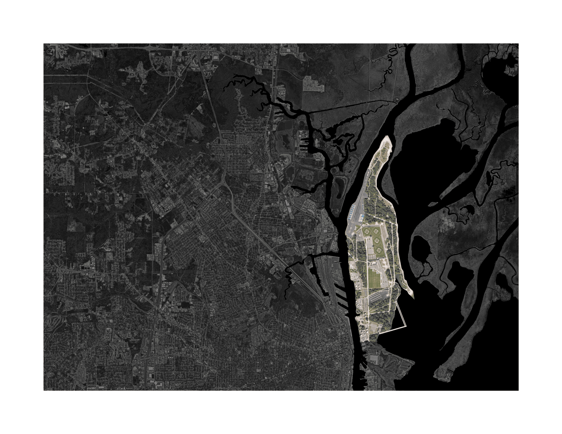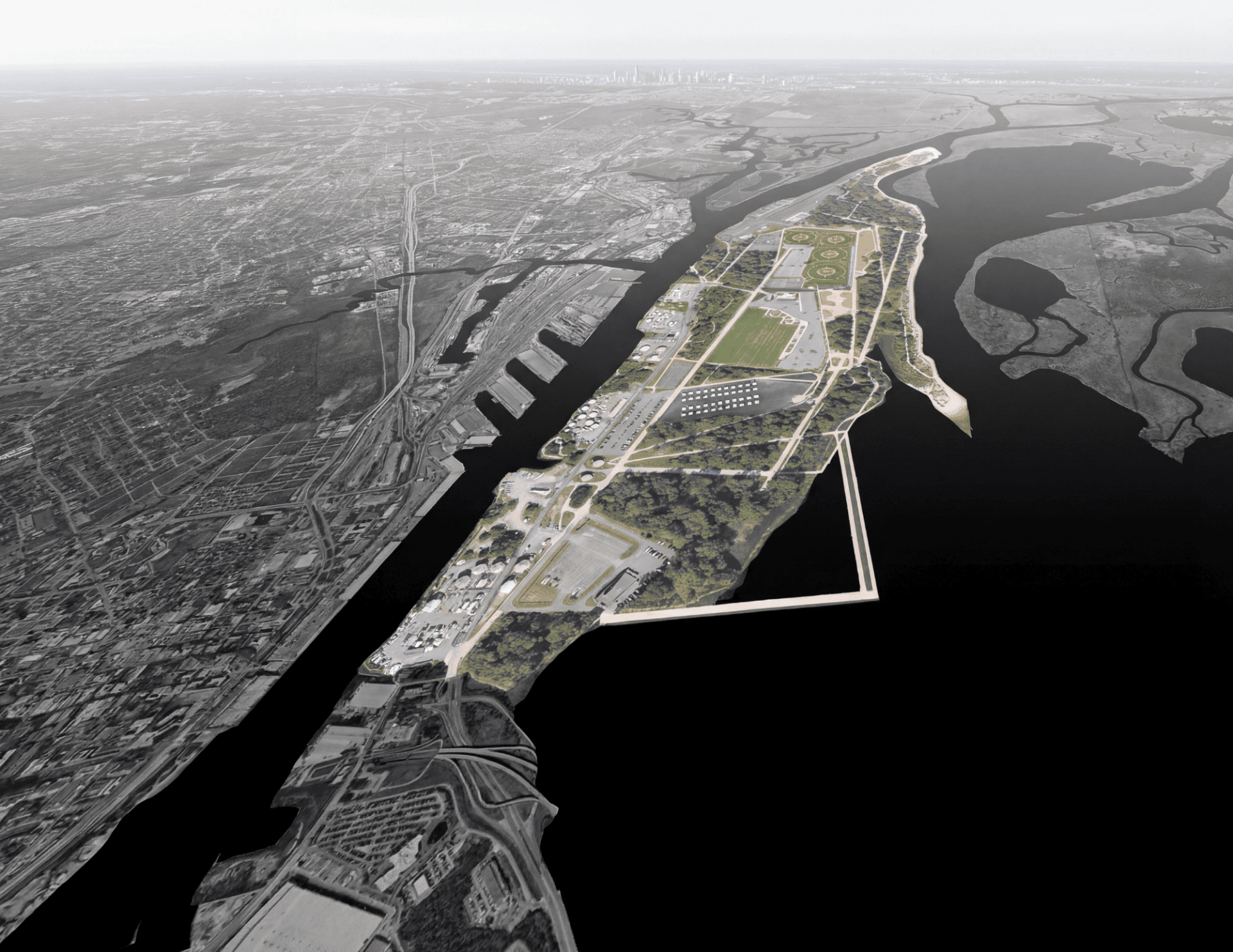
Aerial perspective of Mobile Bay island with a color site overlay against grayscale urban context.

DESIGN WORK · RESEARCH

Reimagining Unconventional Infrastructure as Social and Ecological Connectors

Reimagining infrastructure as landscape, ecology, and civic connector

Annie Neill · Instructor: Robert Sproull · Bachelor of Environmental Design, Class of 2026

TYPE
Commission · Research
YEAR
2025 — 2026
COURSE
Undergraduate Research Fellowship
TAGS
Undergrad · Infrastructure · Ecological Design · Public Realm · Mobile Bay · Mapping · Research
"Infrastructure should not be understood as a fixed utility, but as an evolving framework that mediates relationships between people, environment, and time. By reprogramming underutilized systems through layered design strategies and temporal thinking, infrastructure can shift from a background condition into an active, performative public asset."

INTRO

Infrastructure is often treated as fixed, neutral, and purely functional. In reality, it actively shapes how people move, gather, and access opportunity. This project challenges the assumption that infrastructure must remain static by reframing it as a dynamic system capable of social and ecological performance. Situated within the Mobile Bay context, this research explores underutilized infrastructural landscapes as latent frameworks for connection. These spaces hold the potential to operate as thresholds between movement and environment. Rather than designing new systems, this project investigates how existing conditions can be reinterpreted, layered, and expanded to support evolving community needs and environmental processes.

MATERIALS + METHODS

This project is grounded in a multi-scalar mapping process that integrates real GIS data with iterative spatial analysis. Using ArcGIS, Vexcel aerial imagery, and base GIS layers, the site was reconstructed as an accurate, scalable framework. These datasets were translated through Rhino, Illustrator, and Photoshop to produce layered mappings that reveal disconnection, underutilized land, and limited public access. The project operates across the entire island through three temporal phases — Conception, Mid-Life, and Afterlife — allowing elements to exist simultaneously in different states of use and adaptation. Minimal white overlays distinguish proposed systems from existing conditions, emphasizing addition, speculation, and future potential.
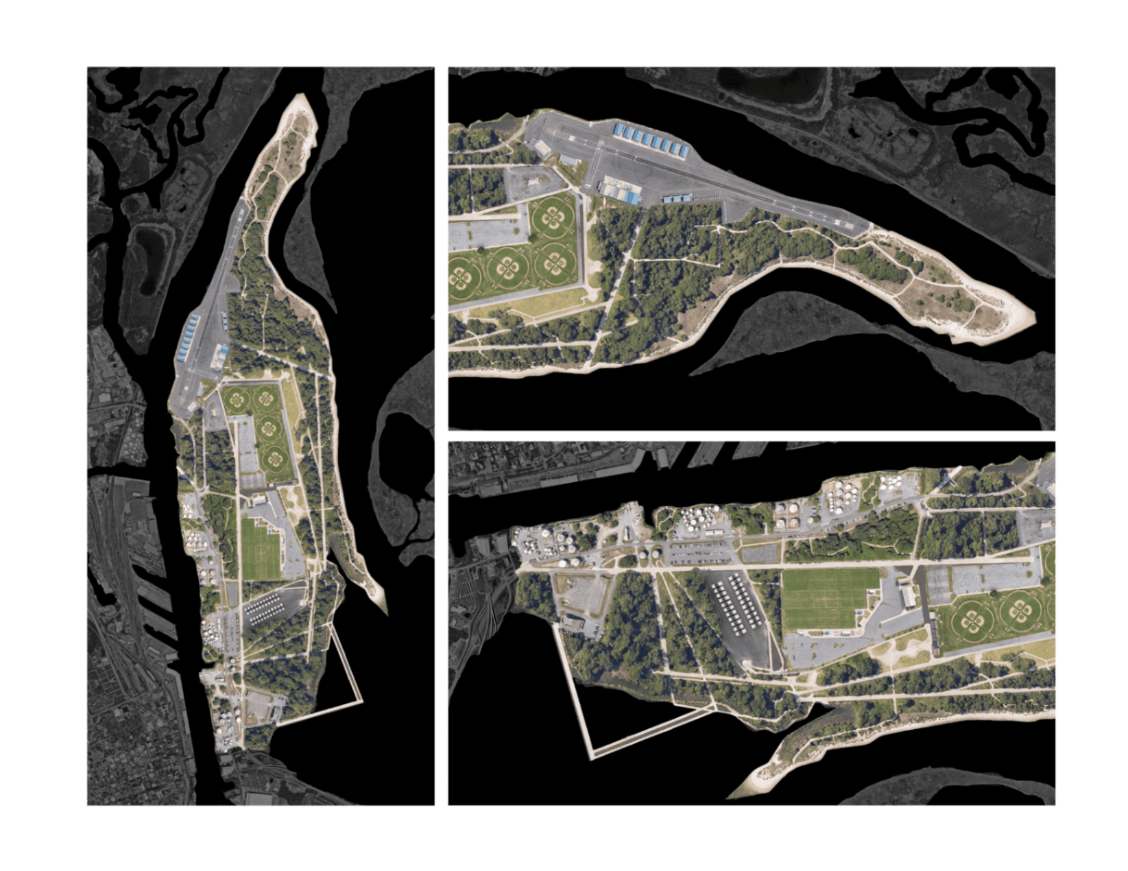
Multi-scale Brookley Field site plans.
Multi-Scale Site PlansThree interlocking site plans reconstruct Brookley Field at full GIS accuracy — from island-wide context to northern and southern sector detail — revealing the latent network of paths, edges, and underutilized land.
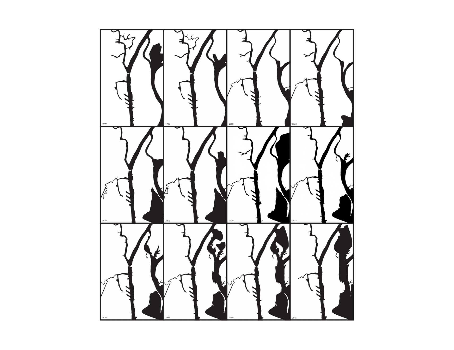
Temporal silhouette sequence showing shoreline migration from 1990 to 2045.
Temporal Sequence · 1990 — 2045A 12-frame silhouette study traces sediment migration and shoreline shift across the Mobile Bay delta — mapping environmental change as a driver of adaptive design strategy.
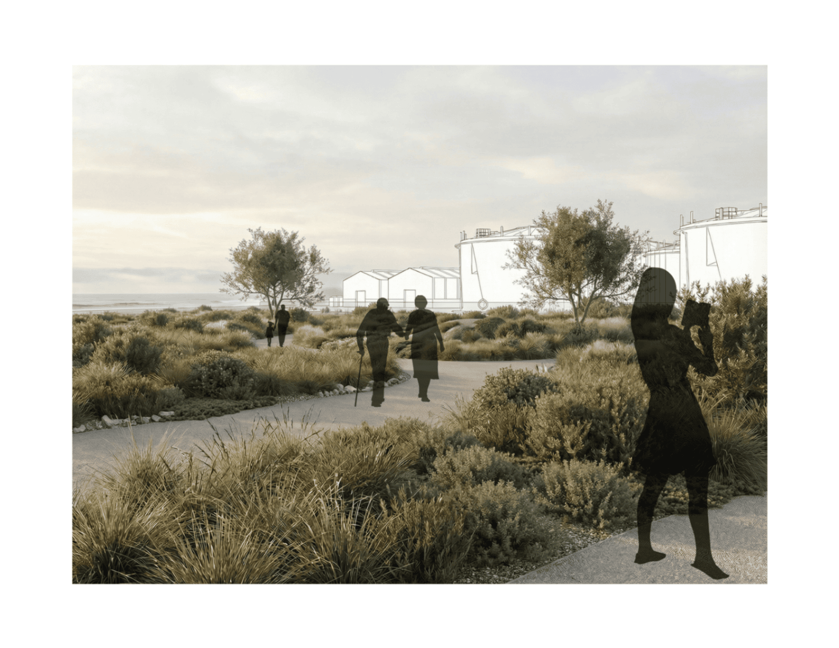
Ecological corridor rendering along the coastal edge.
Ecological Corridor · Conception PhaseA native coastal planting corridor weaves between retained oil infrastructure and the bay edge — proposing ecological remediation and accessible public passage where industrial land previously created barrier.
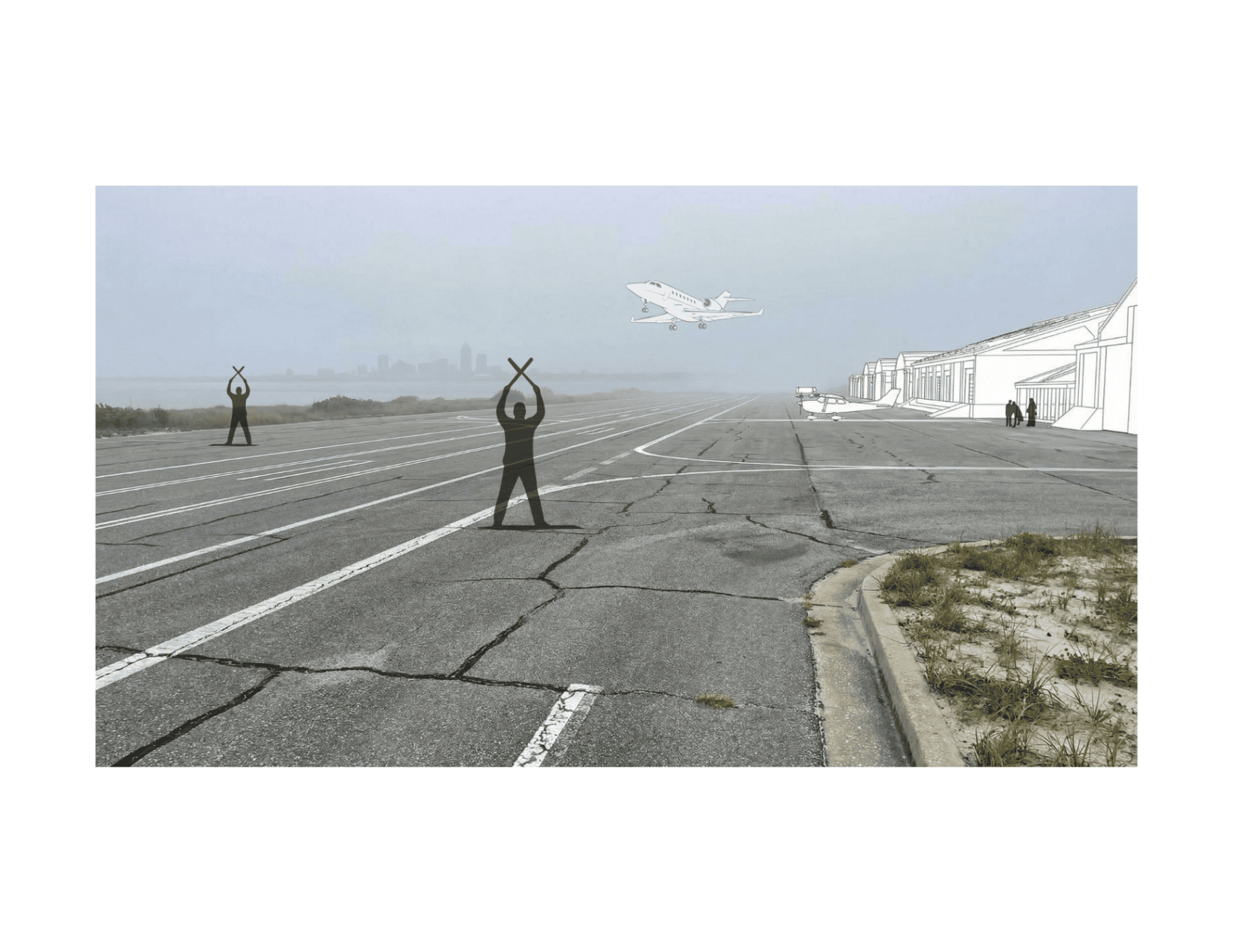
Runway reactivation rendering with public gathering and speculative aviation memory.
Runway Reactivation · Mid-Life PhaseThe former Brookley Field runway is re-staged as a civic threshold — its cracked asphalt and vast horizon reprogrammed as a zone of public gathering, mobility, and speculative aviation memory.
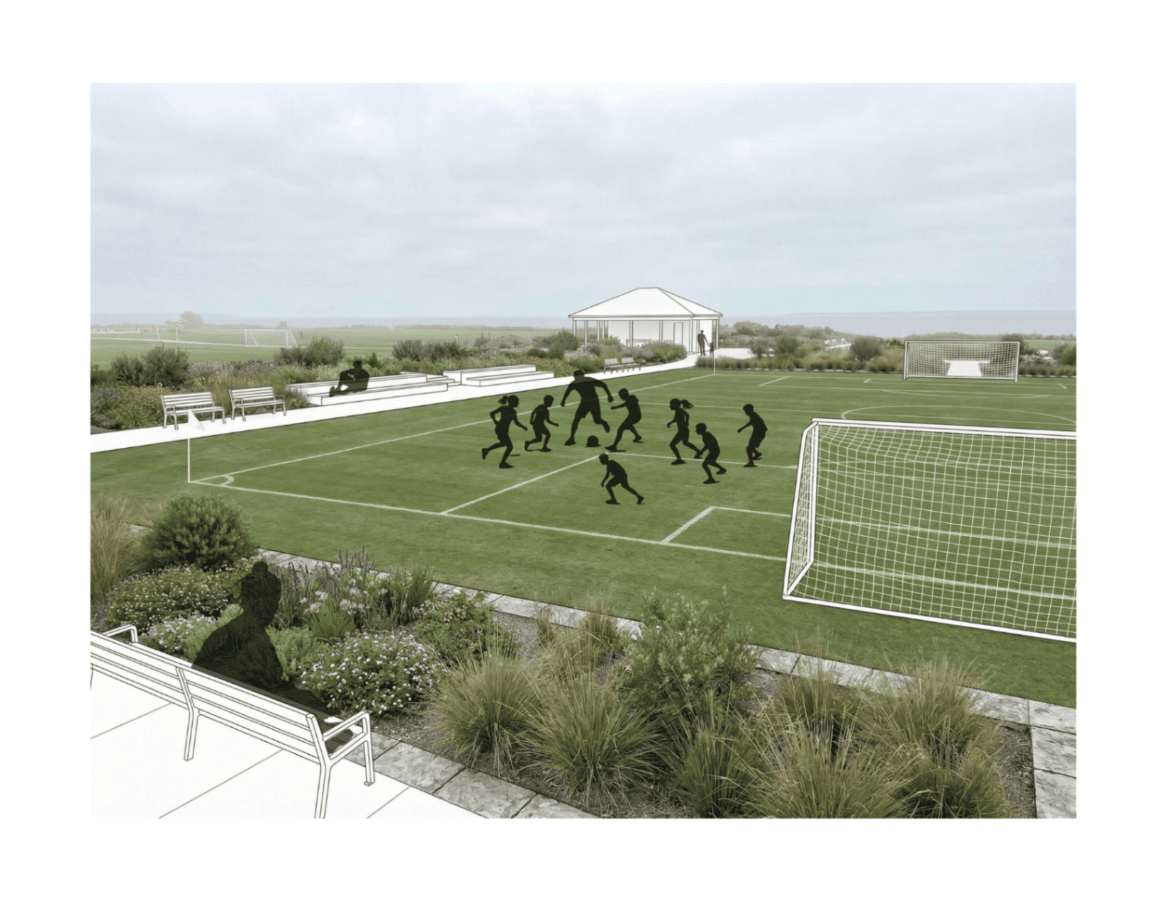
Active recreation fields with terraces and a pavilion along the waterfront.
Active Recreation Fields · Mid-Life PhaseExisting athletic fields are re-edged with native planting, terraced seating, and a waterfront pavilion — transforming underutilized open space into a layered civic landscape visible from the bay.
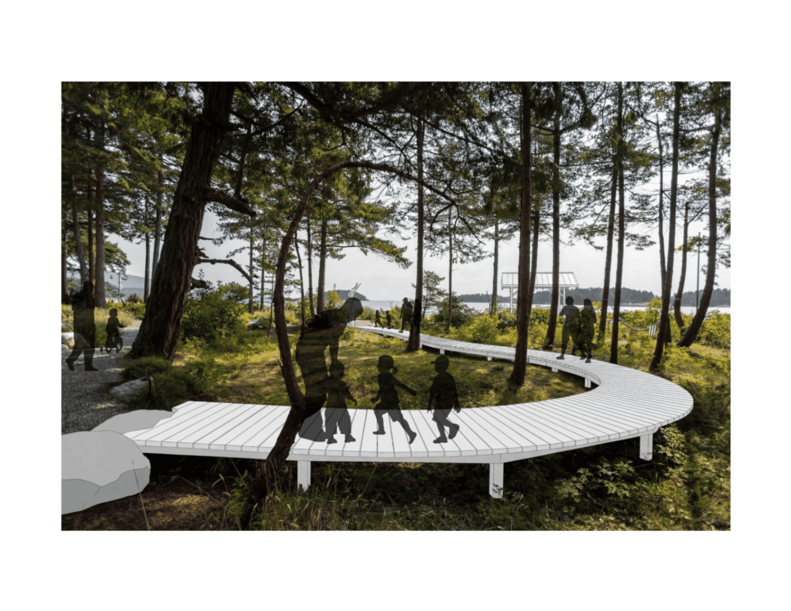
Curved white boardwalk through a mature pine forest.
Forest Boardwalk · Afterlife PhaseA curved white boardwalk threads through the island's mature pine canopy — lifting movement above the ground plane to preserve ecological continuity while opening the forest interior to public access.
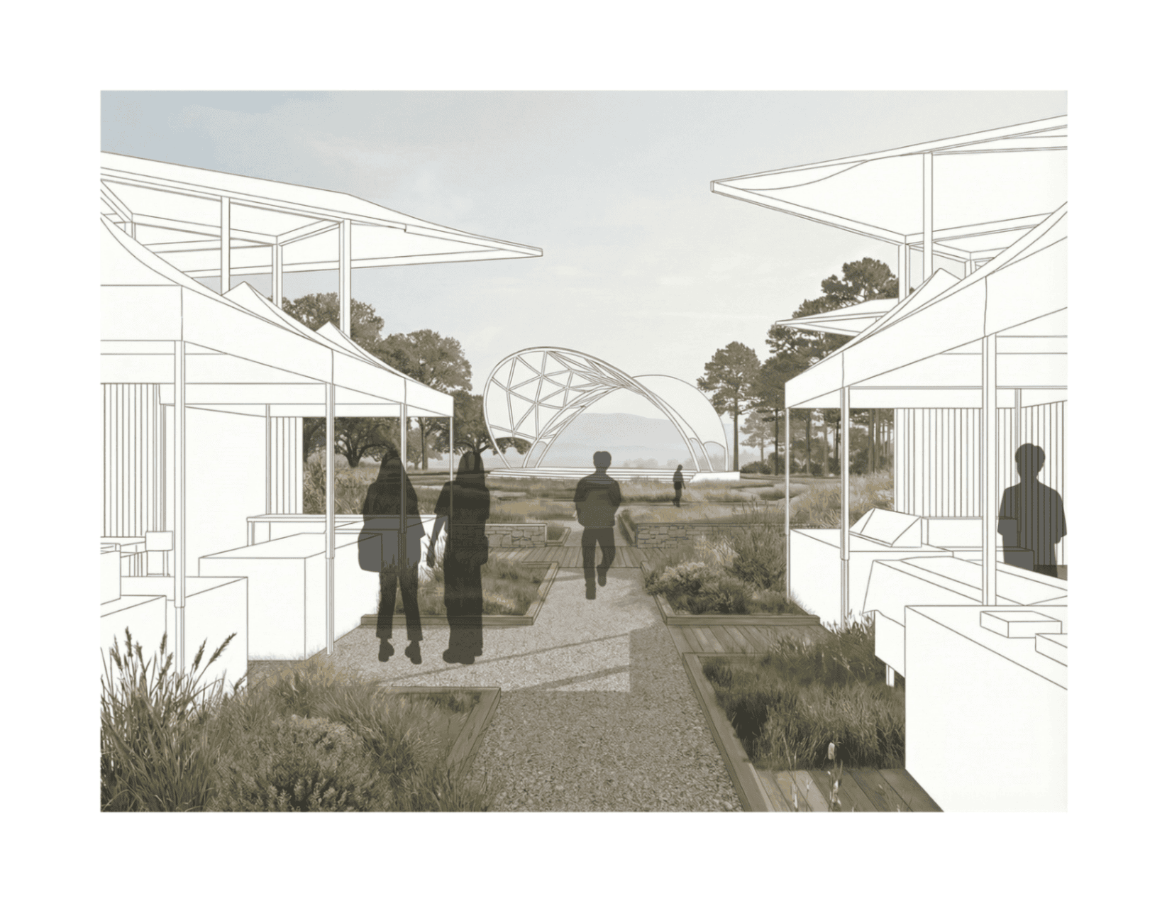
Open-air market pavilion corridor facing the bay.
Market Pavilion · Afterlife PhaseAn open-air market corridor framed by lightweight canopy structures and native meadow planting activates the island's central spine as a social and commercial threshold facing the bay.
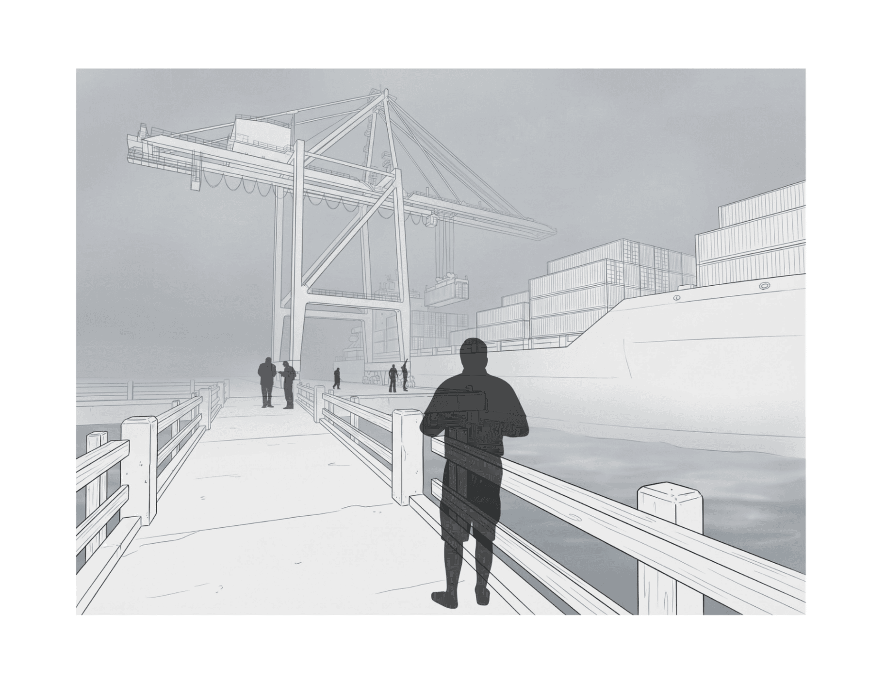
Port observation pier rendering overlooking container logistics.
Port Observation Pier · Conception PhaseA public pier extends into the working port — allowing visitors to witness the scale and rhythm of container logistics up close, reframing industrial infrastructure as spectacle and civic amenity.
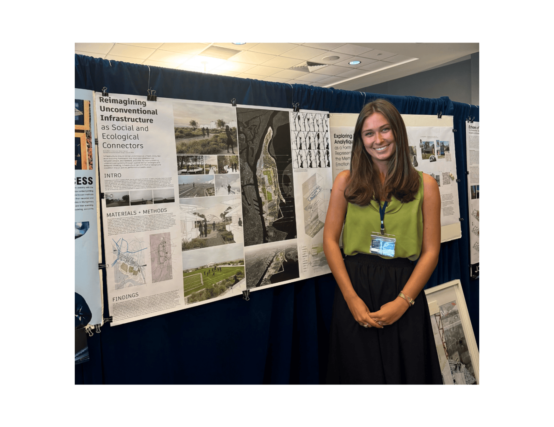
Annie Neill presenting the project at the URF Symposium in 2025.
URF Symposium Presentation · 2025Presented at the Auburn University Undergraduate Research Fellowship Symposium — the project was displayed as a full-scale research poster documenting mapping, analysis, and design proposals across all three temporal phases.
Regional GIS map situating Brookley Field within the Mobile Bay metropolitan area.
Regional Context · Mobile BayA regional GIS map situates Brookley Field within the Mobile metropolitan area — a narrow, isolated peninsula surrounded by water on three sides, disconnected from the city grid by highway infrastructure and industrial edge.
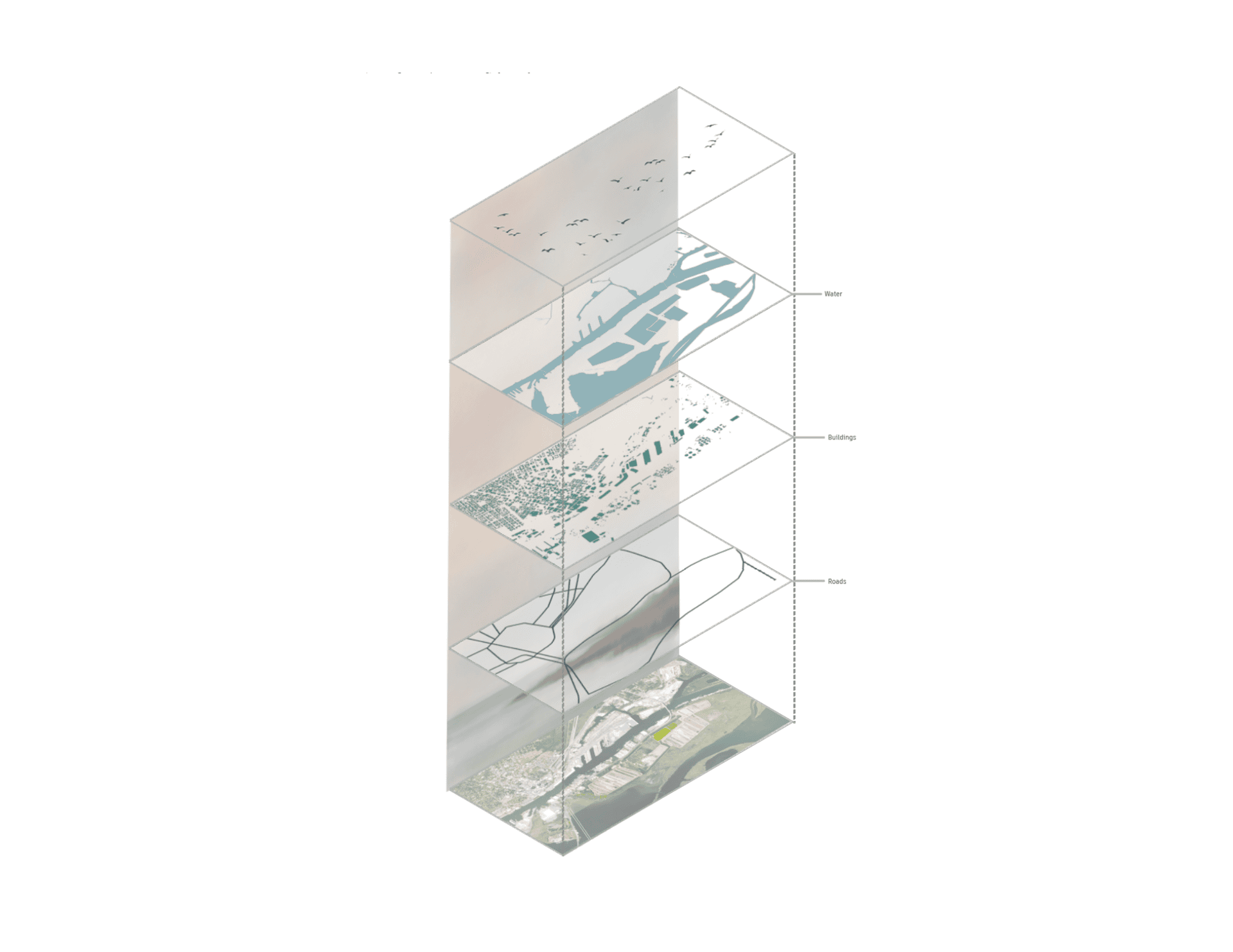
Exploded axonometric showing GIS layers for water, buildings, and roads.
GIS Layer AnalysisAn exploded axonometric separates the site into discrete data layers — water, buildings, and roads — revealing the spatial relationships between infrastructural systems before any design intervention is proposed.
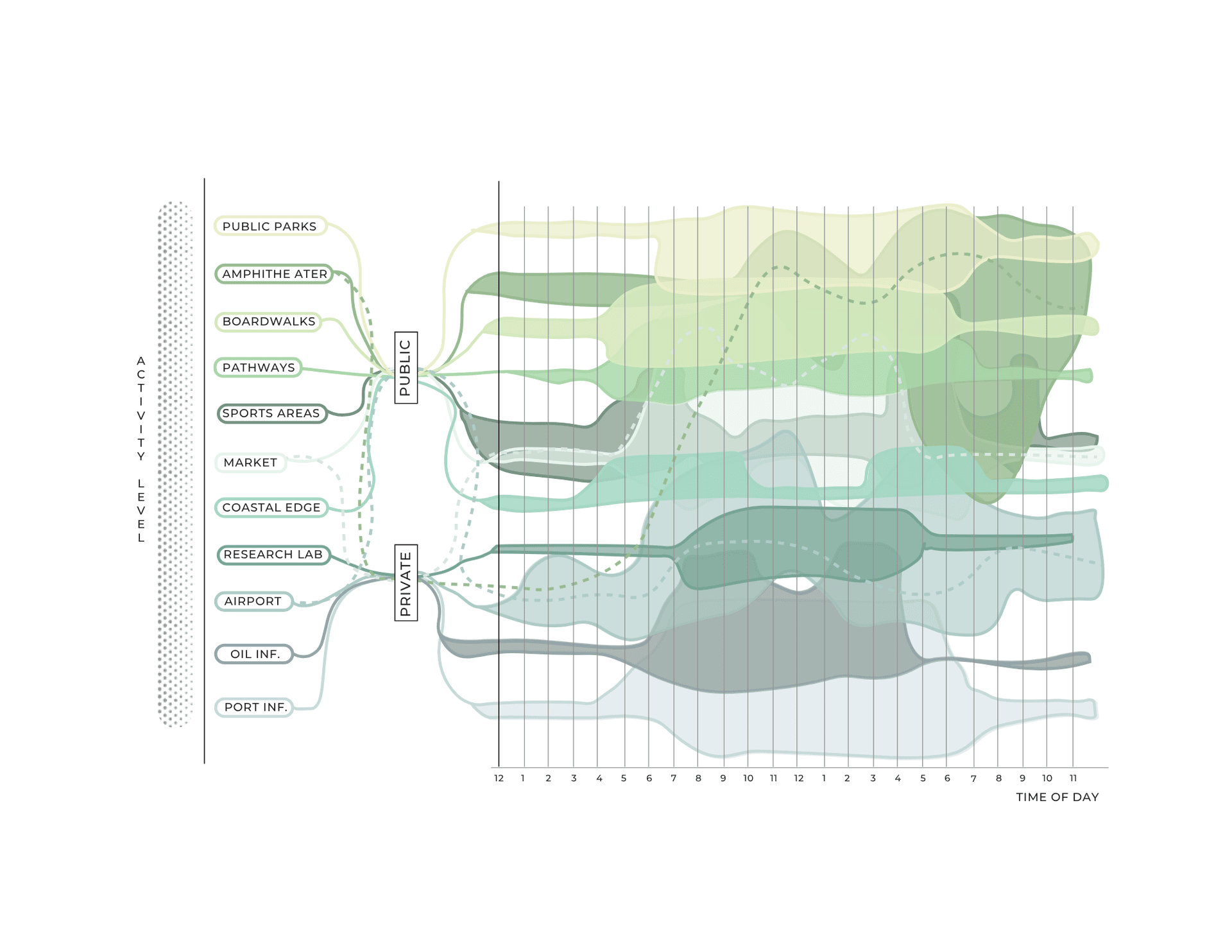
Streamgraph chart mapping program activity levels across a 24-hour cycle.
Programmatic Activity ChartA streamgraph maps activity levels across all proposed programs — from public parks and boardwalks to private airport and oil infrastructure — charting how the island activates and quiets across a 24-hour cycle.
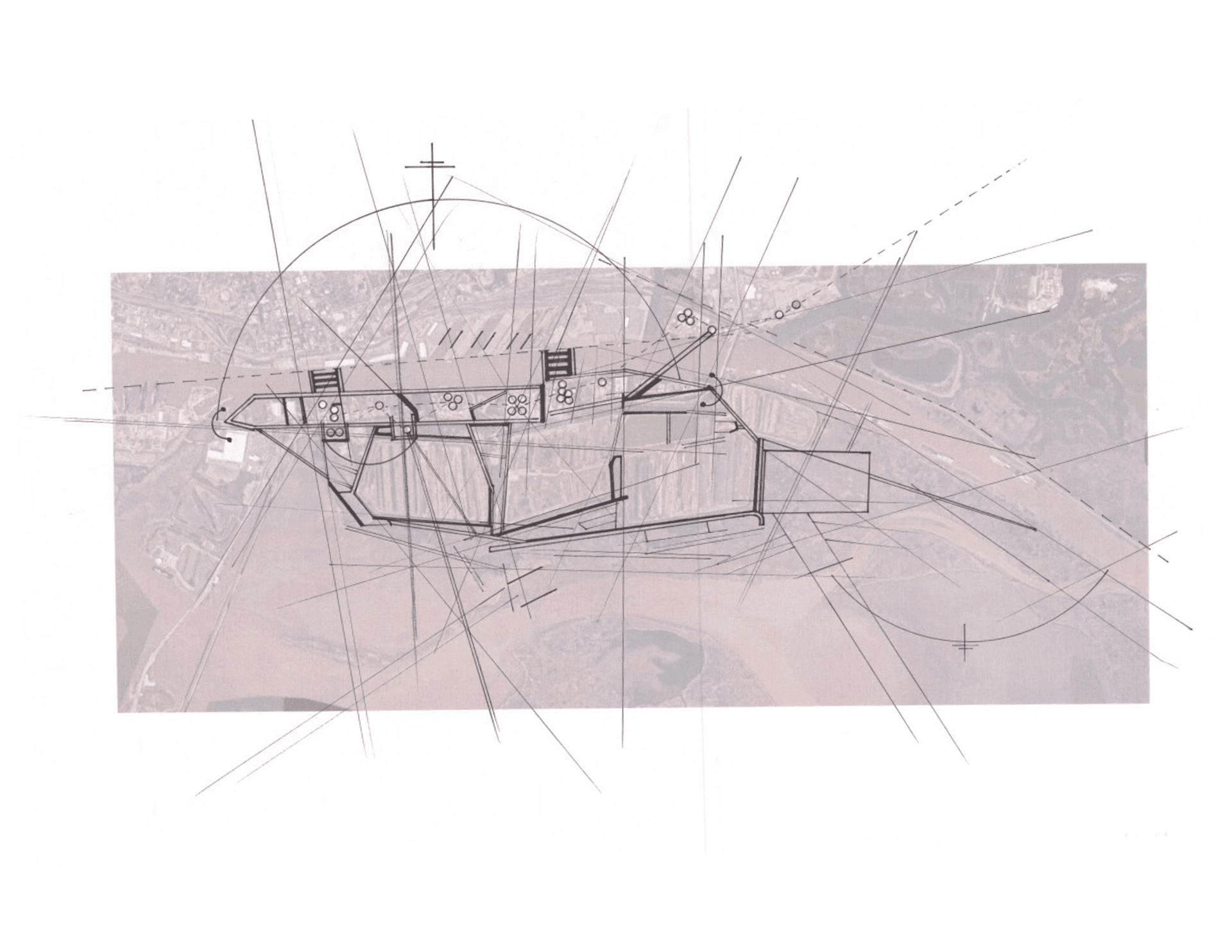
Hand-drawn site circulation study overlaid on an aerial base map.
Sketch Overlay · Site CirculationEarly hand-drawn circulation studies layered directly over the aerial base map — tracing sightlines, access points, and movement systems that would inform the project's iterative design development.
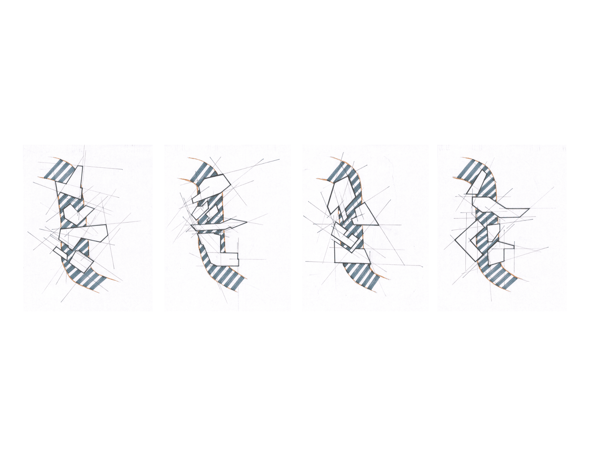
Four sequential plan sketches exploring program organization along the island edge.
Iterative Plan StudiesFour sequential plan sketches test programmatic organization along the island's curved edge — using blue hatching for water-adjacent zones and orange to mark infrastructural thresholds, iterating toward a final spatial system.
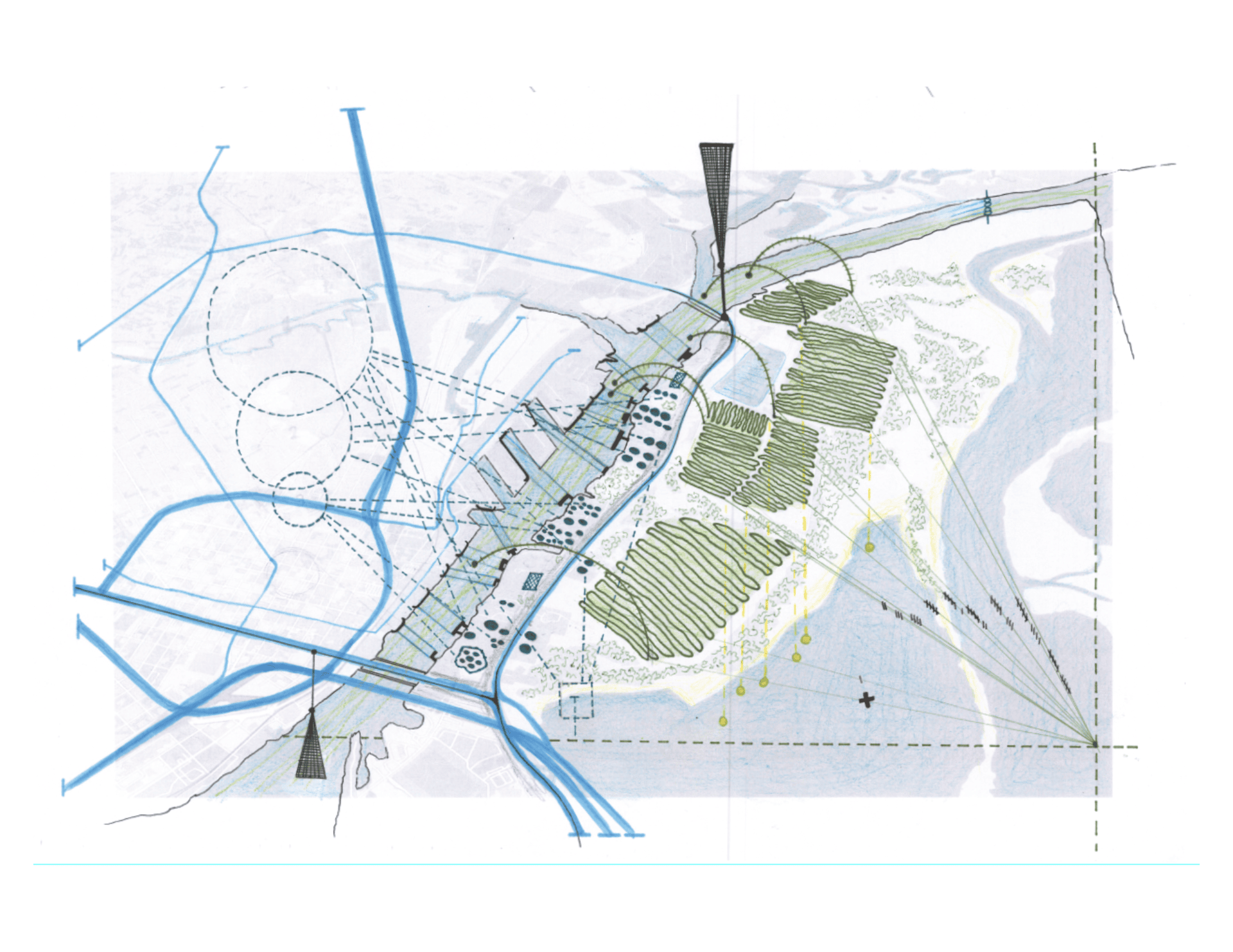
Final master plan showing circulation, ecology, and program nodes across the island.
Master PlanThe final master plan integrates blue circulation networks, green ecological planting zones, and proposed program nodes across the full island — articulating a layered, phased framework for infrastructural transformation.
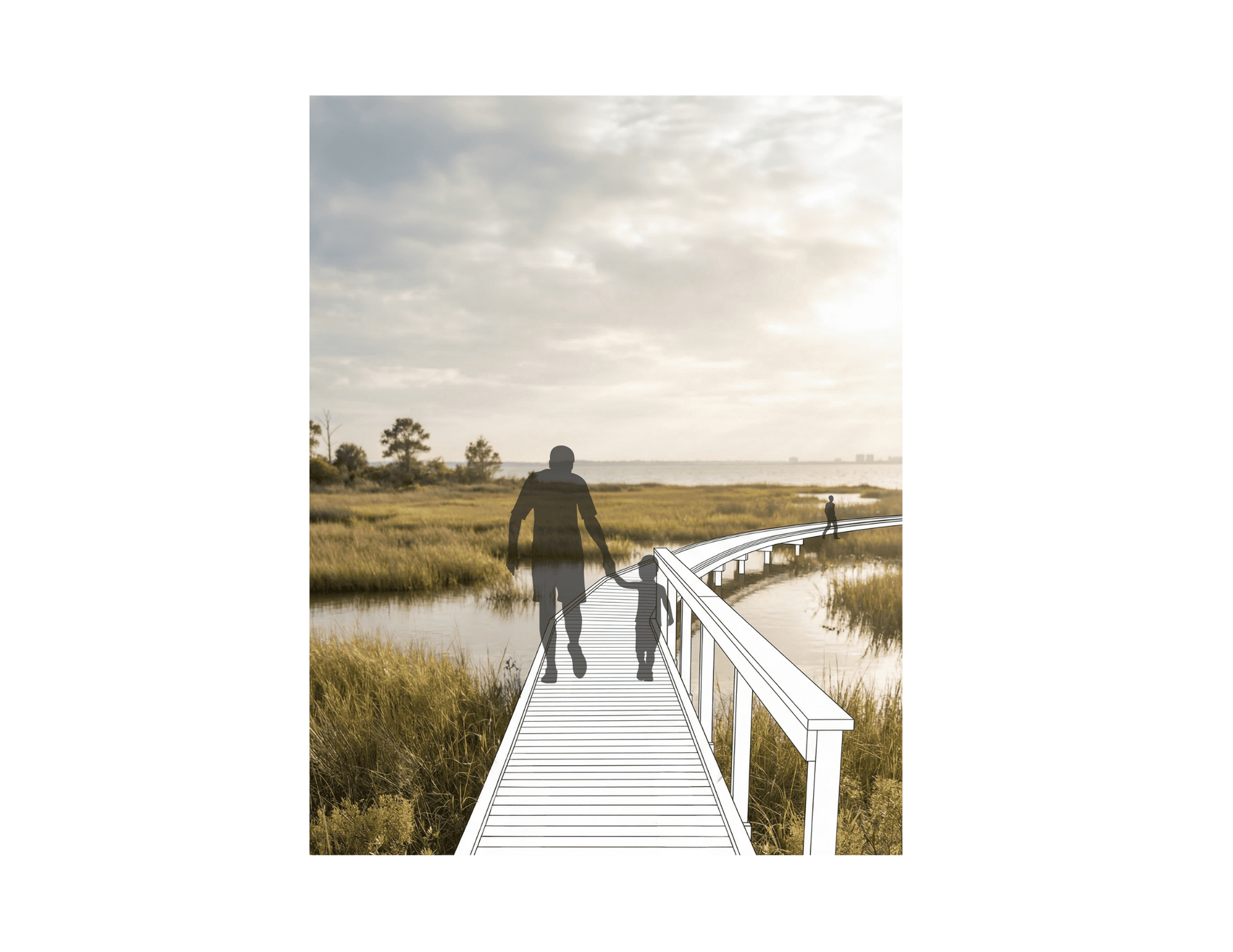
Rendered marsh boardwalk extending toward Mobile Bay.
Marsh Boardwalk · Afterlife PhaseA white boardwalk extends through the coastal marsh toward Mobile Bay — proposing accessible public passage through ecologically sensitive wetland landscape that was previously inaccessible to the public.
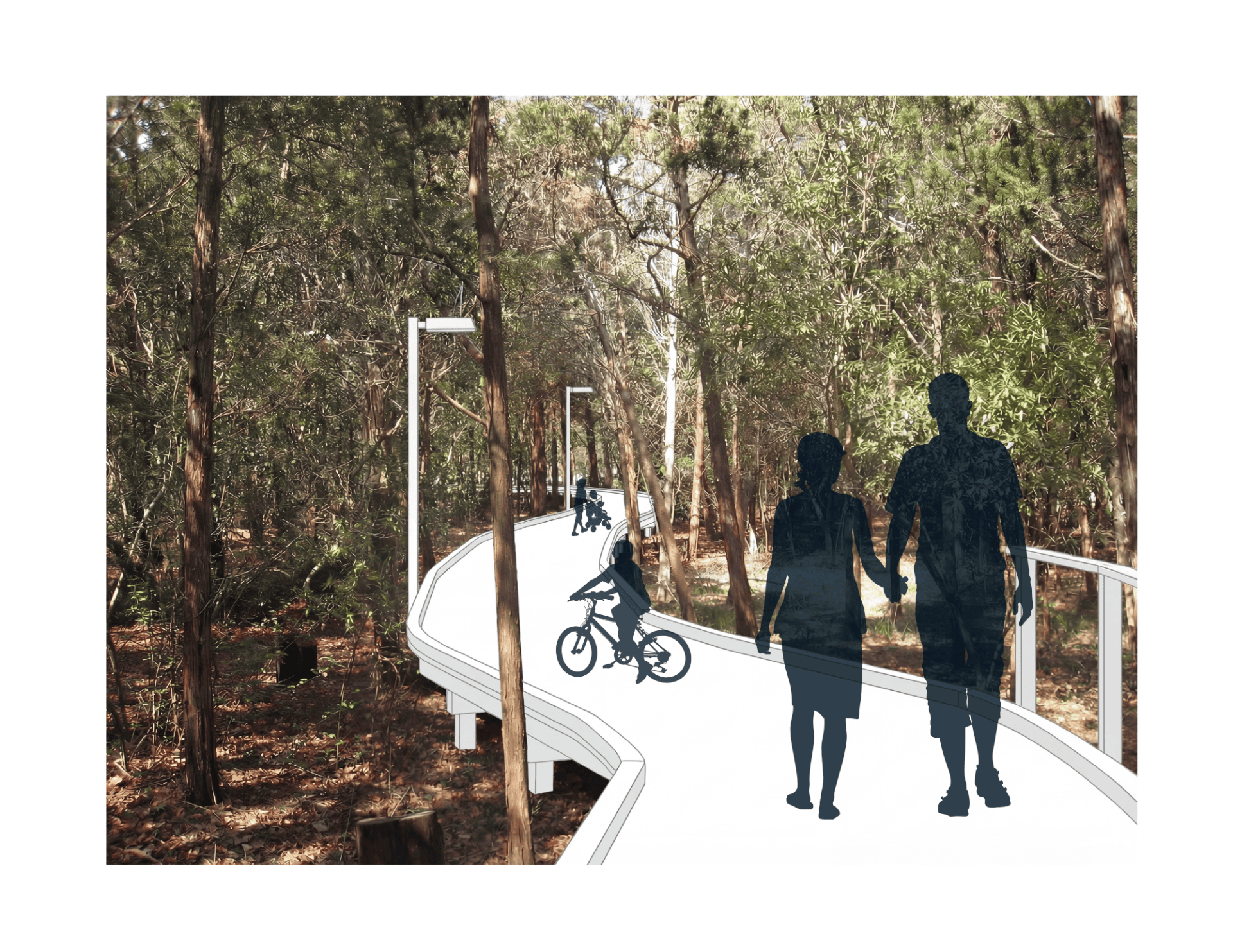
Rendered elevated path winding through the island's pine forest.
Shared Forest Path · Mid-Life PhaseAn elevated multi-use path winds through the island's dense pine forest — accommodating cyclists and pedestrians on a continuous loop that activates the interior landscape as a shared public amenity.
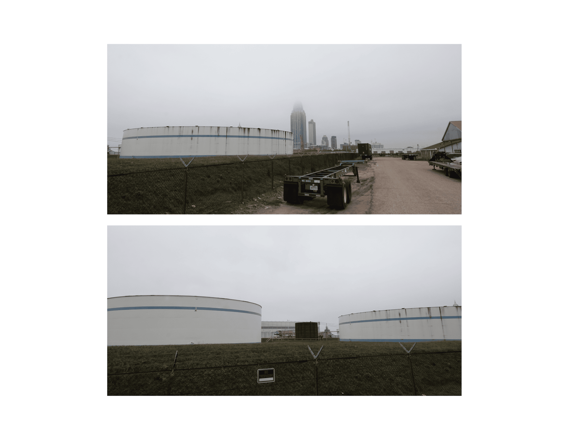
Field photographs of oil storage tanks along Brookley Field's southern edge.
Existing Conditions · Oil InfrastructureField photographs document the large-scale oil storage tanks that define much of Brookley Field's southern edge — industrial infrastructure that the project proposes to reframe as a visible datum within a new public landscape.

Annie Neill

Explore Art WorksExplore Design WorksPortfolio + Resume